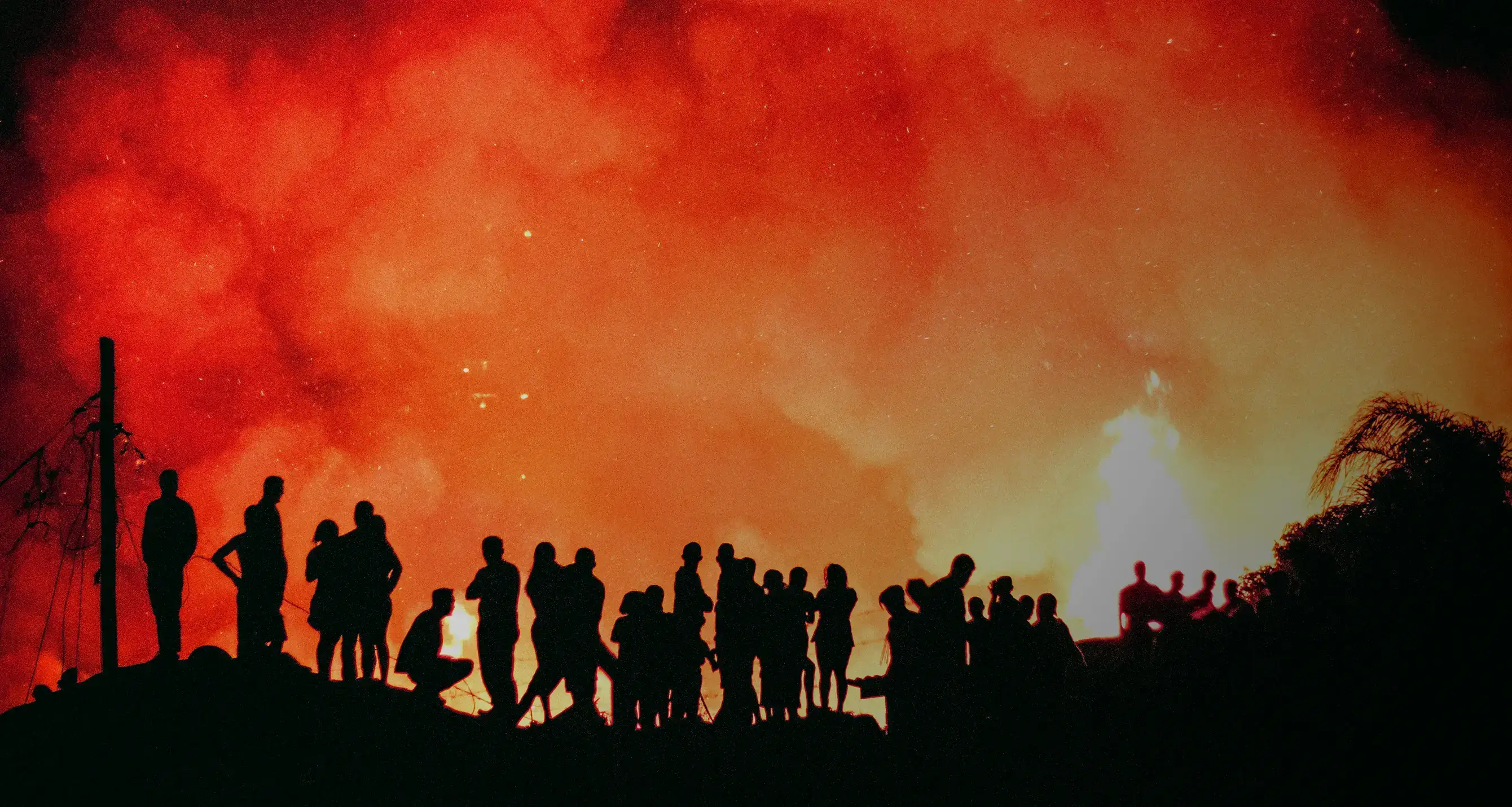
Every year an area around the size of the European Union is burned by fire activity. The UK has historically seen limited wildfire activity, with fires tending to be infrequent and small. In July 2022, we saw UK temperatures reaching 40ºC for the first time. Along with it came widespread fire activity, that saw more than 10 wildfires attended by the London Fire Brigade alone.
Globally there has been an observed decline in the area burned over the last two decades. This has been primarily driven by the expansion of agricultural areas replacing savannah grasslands predominantly in Sub-Saharan Africa, with farmers working at fire suppression to protect their crops. However, while fire has reduced in these agricultural areas, other areas, including the Arctic, have seen increasing fire activity. And areas that previously saw little fire activity (such as the UK) are now experiencing more frequent and severe fires. But how unprecedented are the fires seen in the UK that week, and can we draw any trends?
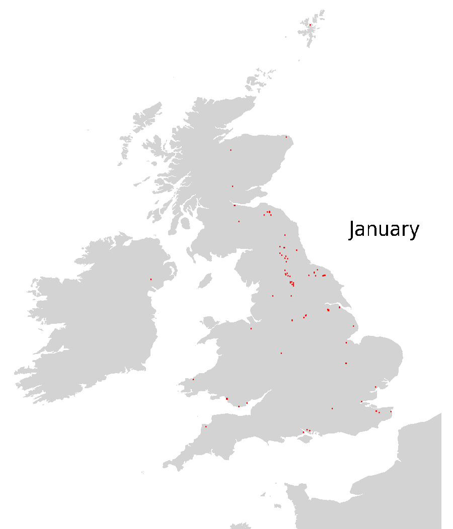
To explore this, we can turn our eyes to the sky and look at the satellite record. Satellites have two main methods of detecting wildfires. First, fires emit an immense amount of heat as vegetation and other materials burn. Some satellites orbiting overhead can detect these heat anomalies and report a fire within as little as an hour, enabling monitoring of fire spread in near-real time. Shown below are all the fires in 2019 over the UK detected by one such satellite instrument.
A downside to this approach is that if the satellite passes overhead after the ground has cooled the fire might be missed. But, fire leaves discernible marks on the land, such as the visible loss of burned vegetation, or the ash and char left behind. This means other satellite instruments can detect these changes and map out the area burned by the fire.
In the satellite image below, we can see the Saddleworth Moor fire just outside of Manchester which occurred in June 2018.

We can use these methods to collate fires detected over the UK in the past years and see that the UK has seen an uptick in the number of fires and total area burned. Recent years have seen larger and more severe fires, such as the Saddleworth Moor fires in 2018 and 2019. However, as of July 2022 has already seen more fires than any other year.
Projecting forward
The picture of the future is more uncertain. Predicting the exact location and timing of a fire is difficult so instead, scientists focus on forecasting “fire danger”- that is the weather conditions that could drive a fire to spread if ignited. Extremes of heat, lack of rainfall and high winds can be combined into metrics such as the Fire Weather Index (FWI), which provide a method for forecasting fire danger. Higher values of FWI are associated with dry vegetation and low soil moisture, which are key drivers in the risk of fire spread. FWI and other indices are generated from weather forecasts to provide a fire danger forecast over the fire season. For example, in the UK, the Met Office produce 5-day forecasts of the Fire Severity Index highlighting areas at risk of fire in the coming days. And as FWI is mereologically driven it can also be projected into the future using climate models. This allows us to project future risk from changes in weather associated with fire danger.
There is evidence that weather events associated with greater fire danger will become more common in the coming decades in many high latitude locations, including the UK. These changes in fire weather could lead to a 50% increase in wildfires by 2100, concentrated in areas that have previously not been fire-prone such as Central Europe and the Arctic. And in the UK, there may be an increase in the number of days with dangerous fire weather of 3-4 times by 2080.
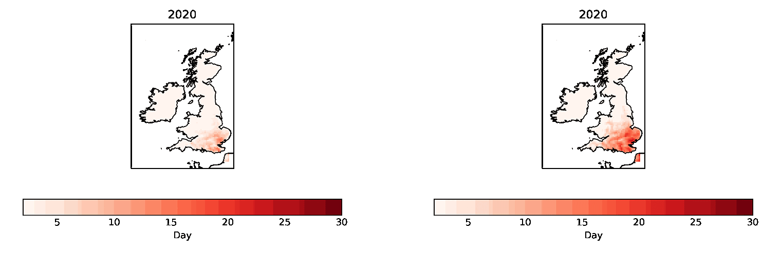
Predicting where and how severe such events will be is a challenge we’re solving at Climate X. We are developing our own projections of fire risk for the UK and worldwide using the latest climate models and Earth Observation data. Shown below are projections for the number of days that the UK will experience high fire danger (where FWI > 30) for low and high future emissions scenarios (RCP2.6 & RCP8.5, equivalent to the PRA and NGFS early/late action and no additional action scenarios).
What's next?
Understanding future fire risk can help us all be prepared and take adaptation action by building resilience to high-risk areas. While there is a cost attached to taking sufficient preventative actions, the projected benefits far outweigh the investment required.
Get in touch with us to learn more about how you can leverage our climate risk platform, Spectra and assess the potential threats posed by extreme weather events, such as fire, drought, flood, heat and subsidence to your assets and portfolio.
