Sample PDF Appendix
BREEAM Climate Resilience Evidence, Ready to Attach.
A climate risk appendix covering BREEAM Resilience issues Res 01–04.
BREEAM's Resilience issues ask for a systematic climate risk assessment: hazards identified, future scenarios modelled, flood risk quantified and adaptation planned. A flood map screenshot and a desktop review rarely survive audit.
Climate X produces a PDF appendix for any asset or portfolio, that your assessor can take straight into the submission.
By clicking 'Download', you agree that Climate X may use your information to contact you about our services or related events.
See how Climate X supported Aroundtown, one of Europe's largest real estate companies.
- Asset managers and owners certifying assets under BREEAM or wanting to increase their score.
- Sustainability and ESG teams running certification across a portfolio.
- Consultants who need defensible climate risk data for BREEAM.
- Investment teams treating certification as a valuation, financing and leasing lever.

What's included
Climate resilience evidence for BREEAM Res 01–04
BREEAM's Resilience issues cover risk assessment, future climate scenarios and adaptation planning. Each one needs hazard data that is specific to the site, forward-looking, and traceable back to a named model.
BREEAM coverage
Resilience issues Res 01–04: risk assessment, future climate scenarios, adaptation planning.
Multiple scenarios
SSP3-7.0 as the base case, SSP5-8.5 as the extreme case.
Time horizons
2025 and 2050 as standard; any year to 2100 on request.
Granular flood modelling
Fathom models at 30m resolution, including fluvial, pluvial and coastal. Defended, with defence degradation modelled to 2050.
Weather hazards
10 hazards, covering coastal flood, river flood, surface flood, storms, tropical cyclones, landslide, wildfire, drought, extreme heat and subsidence. Flood maps for river, surface and coastal flooding are rendered under both scenarios.
Materiality and adaptation
Material above 1% AAL for a single hazard; above 2.5% AAL across all hazards in a given year. Adaptation assessed where projected AAL exceeds 1% in 2050 under SSP3-7.0.
PDF output
Print-ready PDF appendix, single asset or batch-generated across a portfolio.
Where it fits
From single-asset to portfolio.
Certification rarely stops at one building. The same underlying data produces one appendix or several, which keeps evidence consistent across a portfolio and across reporting cycles.
One building, one submission
A complete appendix for the asset under assessment, produced on demand and ready for the assessor.
Batch generation
Run every asset in a certification programme at once, with the same models, thresholds and presentation throughout.
Refresh, don't rebuild
Regenerate for the next cycle as models, scenarios or the portfolio change, without commissioning new consultancy work.
One dataset, several disclosures
The same asset-level risk data supports CSRD, TCFD and lender due diligence, so the evidence base is built once.
The platform behind the numbers
One platform, from asset mapping to financial risk and resilience ROI
Defensible data, documented end to end. Scenarios, horizons and materiality thresholds stated up front. Source model, resolution and vintage recorded for every hazard, with the full methodology included in the appendix.
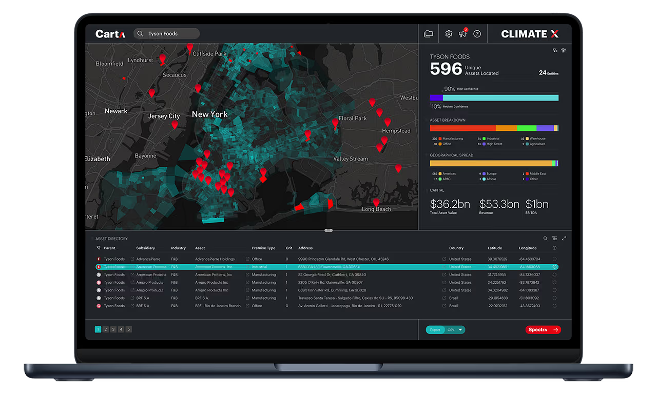
Carta
Carta resolves the asset under assessment to precise coordinates, drawing on a database of 2bn+ assets. A resilience assessment is specific to one building, so the analysis has to sit on the right footprint rather than a postcode approximation.
Spectra
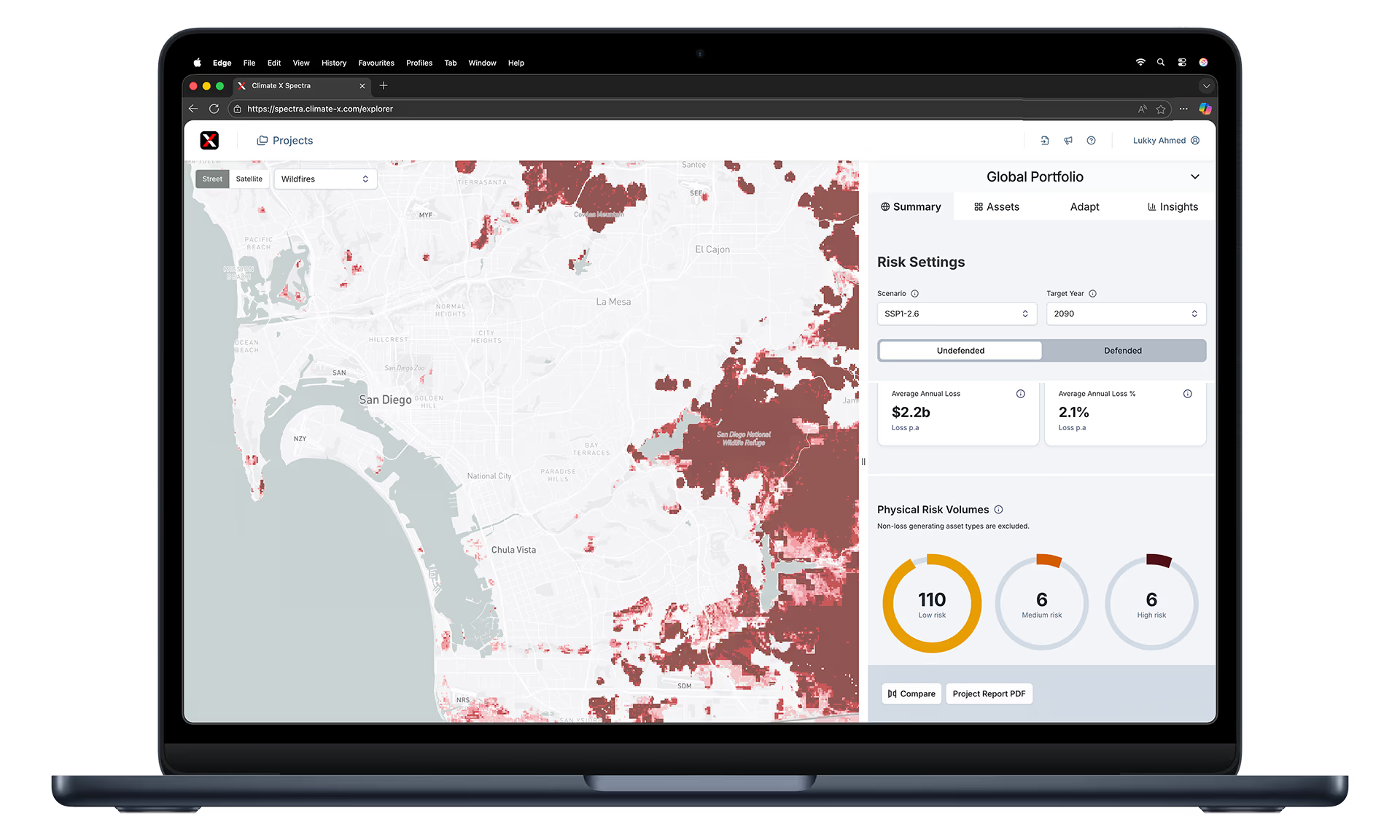
Spectra models physical climate hazards asset-level and translates hazard into financial loss metrics. Materiality thresholds are applied, so the appendix separates real exposure from noise with methodology an assessor can check.
Adapt
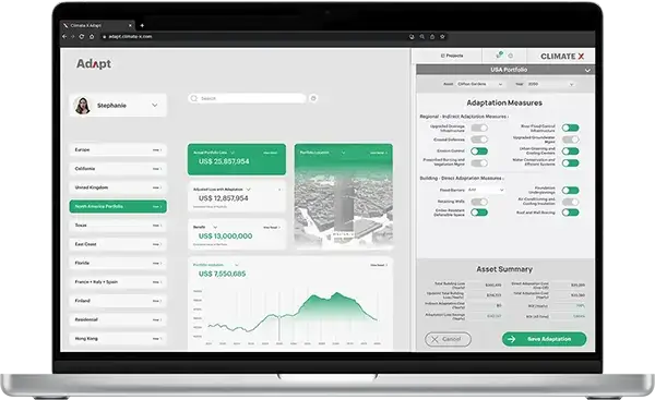
Adapt recommends costed adaptation measures for every hazard above the threshold, comparing losses before and after so each measure carries an expected avoided loss and ROI.
BREEAM and climate risk data: common questions answered.
How do I gather the evidence needed for the climate resilience section of BREEAM?
You need four things: the asset's precise location, modelled data for every relevant physical hazard, projections under recognised climate scenarios to a future horizon, and costed adaptation measures for the risks that prove material. Sourcing these separately means reconciling flood data, heat projections and consultancy findings that rarely agree. Climate X produces all four as a single appendix, modelled at asset level across ten hazards under SSP3-7.0 and SSP5-8.5 to 2050, with methodology stated in full so the assessor can verify it.
What climate risk data does a BREEAM assessment need?
A BREEAM assessment needs asset-specific, forward-looking hazard data. That means flood risk across fluvial, pluvial and coastal sources, wider hazards including extreme heat, storms, drought, subsidence, wildfire and landslide, projections under recognised climate scenarios, an evaluation of which risks are material, and the adaptation measures that follow from them.
Is a public flood map enough evidence for BREEAM?
Usually not. National flood maps show present-day hazard at coarse resolution, with no climate pathway, no future horizon and no view of how defences degrade. BREEAM's resilience criteria are forward-looking and cover hazards beyond flood, so a flood map alone tends to leave several criteria unanswered and invites queries at audit.
Does the same climate data support disclosures beyond BREEAM?
Yes. The asset-level hazard and loss modelling behind a BREEAM appendix is the same dataset used for CSRD, TCFD and ISSB physical risk reporting, and for lender due diligence. Building the evidence base once and drawing on it across frameworks avoids commissioning separate studies that reach different numbers for the same building.