Assess physical risk across complex infrastructure before competitors even get started.
Spatially complex assets like solar, wind, transmission, pipelines, and water utilities, turned into audit-ready risk insight. In minutes, not weeks.
Infrastructure assets don't fit on a single point on a map.
Solar farms span hectares. Pipelines cross watersheds. Water networks branch across catchments. Generic point-based screening misses the spatial reality.
- Weeks of consultant-led desktop studies
- Fragmented data across hazard sources
- Black-box scores or opaque methodology
From asset footprint to defensible insight. In minutes.
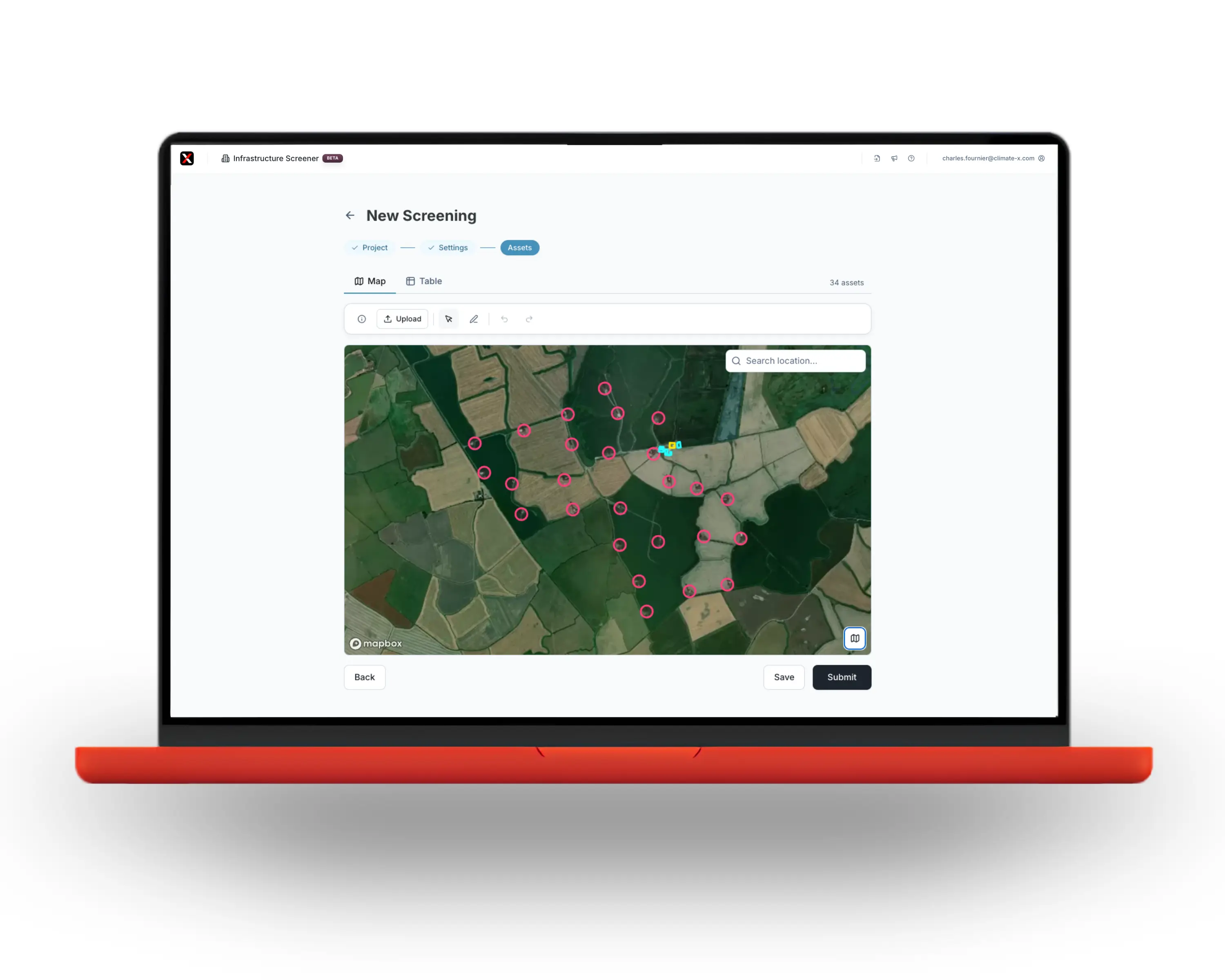
Upload assets. Map sub-components. Draw a boundary. Screen 11 hazards. Walk into IC with answers.
A faster, smarter way to turn climate risk into clear, decision-ready insight.
Built for spatial complexity
Generation sites, transmission, pipelines, water networks. Spatially aware screening for assets that span more than a postcode.
Self-serve, at speed
Replace manual workflows with repeatable screening. No tickets. No Power BI builds. No consultants.
Decision-ready outputs
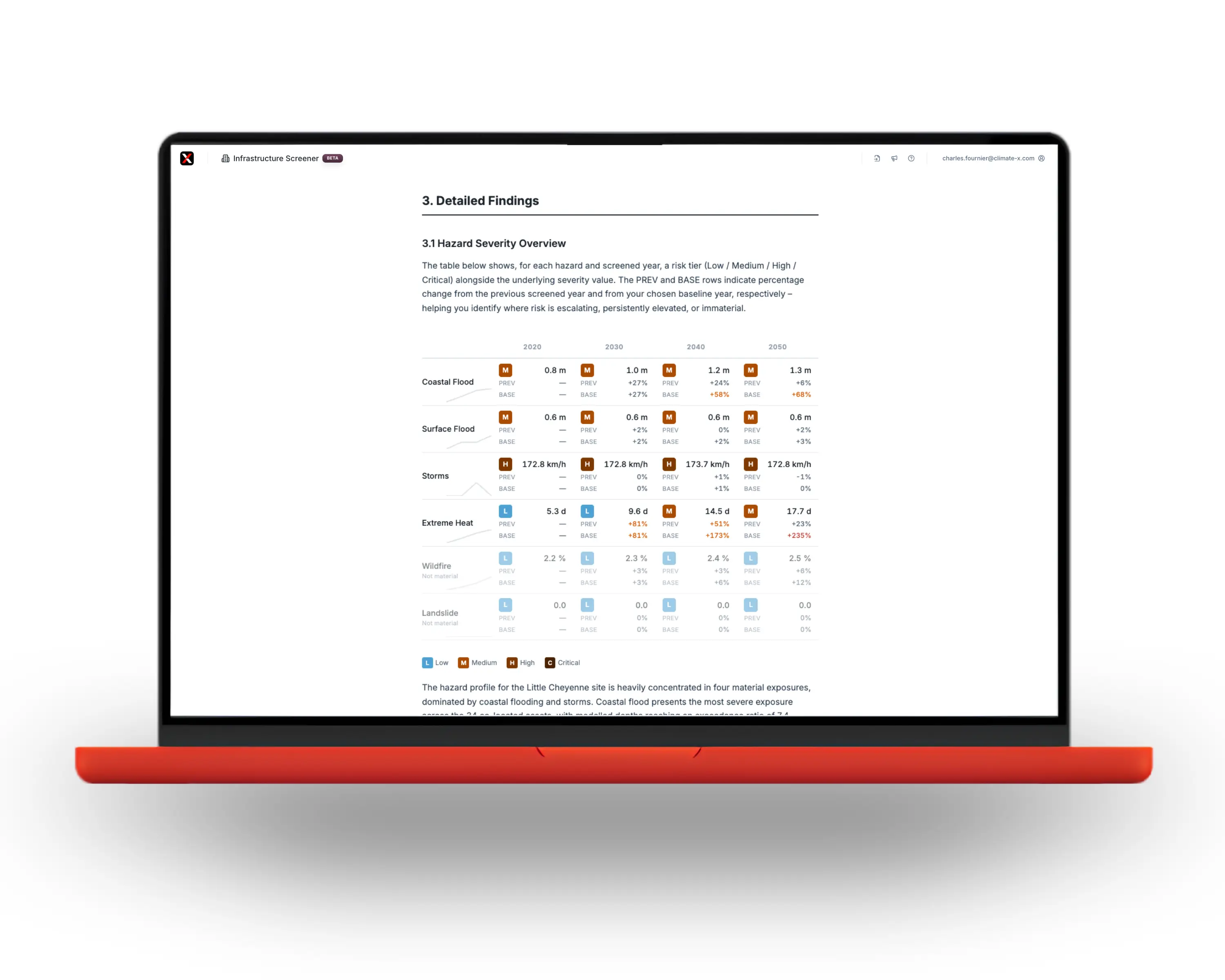
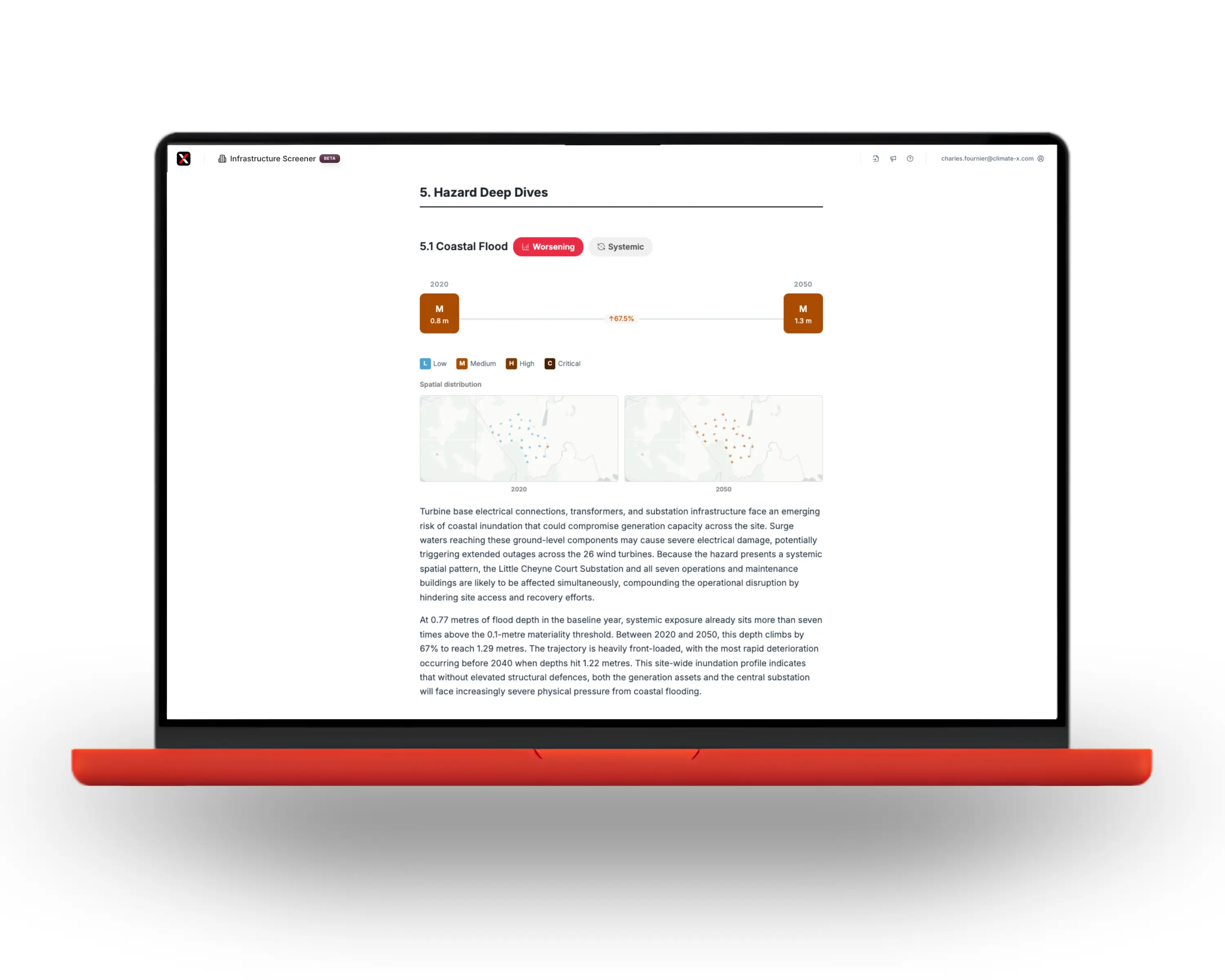
Hotspots, time-horizon shifts, scenario deltas. AI-enhanced reports your committee will trust and your second-line can defend.
“What you want to see is the progression from exposure to vulnerability, to impact assessment, and ultimately financial materiality.”
Dominik Varga, Senior Investment Professional, Copenhagen Infrastructure Partners
One Screener. Every asset class your portfolio touches.
From point-based generation to thousand-kilometre networks. Built for the assets that don't fit on a pin.
Solar & wind
Generation sites, sub-asset hotspots.
Energy transmission
Substations, lines, corridors.
Pipelines
Full routes and crossings.
Water utilities
Treatment, networks, catchments.
Roads
Surface, embankment, bridges.
Rail
Track, signalling, depots.
Three steps. From asset footprint to investment committee.
See it screen your portfolio.
Bring a real asset like a solar site, wind farm, transmission line, pipeline, or water network. We'll run it through the Screener live, and you'll leave with the report.
30-min walkthrough No prep required Tailored to your asset class

