TL;DR
- Dr James Brennan, Head of Science at Climate X, assesses how UK wildfire risk changes between now and 2100 under a high-emissions pathway, right down to the level of individual local authorities, using the Climate X Global Wildfire model.
- What the modelling reveals is that risk isn't rising evenly. It's surging fastest through a corridor running from Manchester to the Peak District, with fresh hotspots emerging near Northern Ireland and south of London.
- UK high-risk wildfire land grows 14% by 2100 under a high-emissions pathway, but the most severe risk category grows even faster, up ~20%
Audio Deep Dive
Duration: 23 mins

Climate X
This Is Not an Isolated Incident
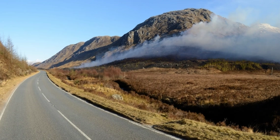
By mid-July 2026, around 19 wildfires were burning across England and Wales and this number could grow over the remaining summer months. A major incident was declared near Sychnant Pass on Conwy Mountain in North Wales, where a blaze spread rapidly in high winds. Another was declared across the Peak District near Glossop, where crews tackling fires at Tintwistle Moor and Arnfield Farm watched the fire reignite overnight and escalate, drawing in mutual aid from neighbouring services, mountain rescue and United Utilities. Parts of southern England, including London, have been placed at "extreme" wildfire risk.
This is not an isolated incident. Last year was the UK's worst year on record for wildfire extent, with almost 48,000 hectares burned, surpassing the previous record set in 2019 by more than 19,000 hectares. The Moorland Association estimated the 2025 season had cost the UK in the region of £460 million by September, using an average of £10,000 per hectare burned.
Each of these statistics is backward-looking, meaning it relates to what has already burned. For anyone who holds, lends against or insures UK property and infrastructure, a forward-looking perspective will be more important. This will mean identifying locations sitting in a rising-probability band and understanding asset exposure and projected financial losses from damage.
What Climate X Modelling Shows
We analysed how wildfire risk changes across the UK using the Climate X Global Wildfire model, comparing today’s exposure with projections to 2100 under a high-emissions pathway (SSP5-8.5).
Key Climate X Findings:
- ● The area of the UK at 1-in-250 year risk threshold increases 14% by 2100 under the SSP5-8.5 scenario
- ● As a share of the country's total land area, this represents a rise from 0.94% to 1.07% of UK landmass falling within this risk category
- ● At the more severe 1-in-100 year threshold (annual burn probability of 1% or greater) the increase is greater at ~20%. At-risk area grows from 131 km² to 157 km², a smaller absolute increase of 26.0 km²
Taken together, the table shows a consistent pattern: the area of the UK exposed to wildfire risk grows meaningfully by 2100 under a high-emissions pathway, and that growth is proportionally faster at the more extreme end of the risk scale than at the more moderate one, even though the extreme category remains a small share of total land area in absolute terms.
Learn more: see how wildfire risk is changing across Europe
How Wildfire Risk Varies Across Local UK Authorities
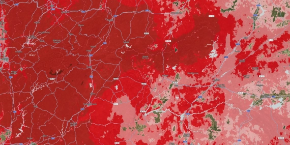
Across the UK, wildfire risk is predicted to rise unevenly. The steepest relative increases concentrate in a handful of local authorities rather than spreading nationally, clustering around Northern Ireland, the area south of London, and a corridor running through Manchester and the Peak District. Some local authorities could see at-risk land more than double under this pathway, while others change comparatively little and the areas with the largest percentage increases are not necessarily those with the most at-risk land overall.
That Manchester to Peak District corridor is worth noting. It includes the ground around Glossop, where crews declared a major incident this summer (July 2026).

What This Means for Asset Owners and Lenders
For many years, Wildfire has been a physical hazard UK institutions could largely leave out of their risk assessments, but changing risk profiles are changing that.
For asset owners, wildfire exposure feeds directly into asset-level Average Annual Loss, valuation, indirect disruption costs, insurance cost and the case for adaptation spend. For insurers, a hazard that is shifting faster than the historic record is precisely the kind that underwriting and reserving models built on past claims are slow to capture. For lenders, collateral sitting in a rising-probability corridor, could become financially vulnerable.
Sources
[1] Channel 4 News, "Wildfires rage across parts of the UK," 13 July 2026. https://www.channel4.com/news/wildfires-rage-across-parts-of-the-uk
[2] Yahoo News UK, "Peak District blaze now major incident as 'exceptional' wildfire risk to spread," 12 July 2026. https://uk.news.yahoo.com/huge-swathe-england-risk-exceptional-125600848.html
[3] Derbyshire Times, "Update after major incident declared as fire crews continue to tackle Peak District wildfires," July 2026. https://www.derbyshiretimes.co.uk/news/emergency-incident/update-after-major-incident-declared-as-fire-crews-continue-to-tackle-peak-district-wildfires-8792829
[4] Moorland Association, "The Glossop Moor Fire and the Case for Controlled Burning." https://www.moorlandassociation.org/post/the-glossop-moor-fire-and-the-case-for-controlled-burning
[5] "2025 United Kingdom wildfires," EFFIS data via Wikipedia. https://en.wikipedia.org/wiki/2025_United_Kingdom_wildfires
[6] Moorland Association, "Wildfires Have Cost the UK Nearly Half a Billion Pounds So Far in 2025," 19 September 2025. https://www.moorlandassociation.org/post/wildfires-have-cost-the-uk-nearly-half-a-billion-pounds-so-far-in-2025-says-moorland-association
Next Steps
Wildfire is a growing physical risk, and its impact reaches well beyond insurance, into valuations, exit assumptions, financing terms, and board packs.
Climate X's wildfire model gives banking, asset management, insurance, and private equity teams defensible wildfire risk data and asset-level loss figures.
Whether you're building a wildfire risk assessment process from scratch or pressure-testing your current wildfire modeling software, we'd welcome the conversation.
Our Latest Articles & News
A selection of some of our latest articles covering industry, policy and climate science - written by us.